Showing posts with label D.C. planning. Show all posts

Tuesday, October 30, 2007

U.S. N.C.P.C.'s Lies about Latest Demolition Special-
Camden's 1325 South Capitol Street
Falsely Claims Compliance with recommendations of Extending the Legacy

NCPC Executive Director Patricia E. Gallagher (center),
with NCPC Chairman John V. Cogbill, III (right)
http://www.ncpc.gov/UserFiles/File/NCPC%20Commission%20Actions%20and%20EDRs/2007%20NCPC%20Commission%20Actions%20and%20EDRs/August%202007/8.2.07%20-%20ZC%2006-41%20(delegated)%20Camden%20dev.%20on%20South%20Capitol%20St._.pdf

Pursuant to delegations of authority adopted by the Commission on August 6, 1999, 40 U.S.C. §8724(a), and DC Code §2-1006(a), I find that the proposed planned unit development and related map amendment for the Camden residential development at 1325 South Capitol Street would not be inconsistent with the Comprehensive Plan for the National Capital, nor would it have an adverse impact on any federal interests. ...

The project is located at 1325 South Capitol Street on Square 653, Lot 111. The proposed map amendment will rezone the property to C-3-C (Commercial) from C-2-C. The C-3-C zoning permits a maximum height of 90 feet and Floor-to-Area Ratio (FAR) of 6.5. The C-2-C permits 90 feet in height and an FAR of 6.0. The project consists of an 11-story residential structure at 110 feet in height. The project is setback 15 feet from the South Capitol Street right-of-way, and steps down to 70 feet on its western side, adjacent to the existing residential town homes.

This map amendment is consistent with the recommendations of the South Capitol Street Task Force and the Extending the Legacy Plan. The project respects the 15-foot setback for South Capitol Street as recommended by the Task Force [BUT NOT BY EXTENDING THE LEGACY] and provides new residential opportunities for the emerging redeveloped neighborhood. As such, this proposal will not negatively impact any federal interests nor be inconsistent with the Comprehensive Plan for the National Capital.
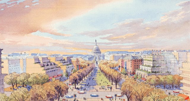
Opening up the South Capitol vista was a major point of NCPC's planning through the 1990s with Extending the Legacy: Planning America's Capital for the 21st Century, and as late as September 2001 with its publication Memorials and Museums.


But NCPC like the rest of our government would mysteriously go apostate- a decision benefiting only a single building along South Capitol Street, the St. Vincent de Paul Church at the intersection with M Street.

Monday, July 31, 2006

The Historic Opening
of the East of South Capitol Street vista:


If only temporarily...


(Photos and captions by Jacqueline Dupree)

Looking north into the stadium footprint from South Capitol Street and Potomac Avenue, the southwestern edge of the site, just before demolition began. (04/06)

The same location, six weeks later (May 20). Much of the demolition is finished. (And the Capitol Dome is more visible now, too.) (05/06)

For more photographs, see the stadium page of Jacqueline Dupree's
"Near Southeast" DC Redevelopment site.

http://www.jdland.com/dc/stadium.cfm

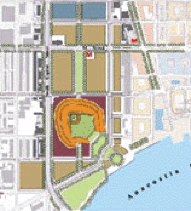
In a sense like the NCPC's 1990s promise of opening up the South of the Capitol building vita, only to be quietly scaled back and dropped, the eastern half of this vista will exist briefly as buildings are demolished to make space for new buildings en mass with the Nationals Stadium complex between Potomac Avenue and N Street SE and its northward adjoining "Ballpark District" between N and M Streets SE.

The recent building demolitions for the stadium complex has opened up the vista northward from Potomac Avenue SE to N Street SE. Note her notation: (And the Capitol Dome is more visible now, to.) Yes, "now" as it becomes significantly less visible with the mass of a baseball stadium with its west wall a more 15 feet of South Capitol Street's existing 130 foot wide right of way.

This will happen to north of N Street, with new development projects, such as that of Monumental Reality at the south-east corner of the intersection of South Capitol and M Streets, where the November 2003 ULI SCS Advisory Services Panel Report and the subsequent March 2005 NCPC South Capitol Street pamphlet show with an open square, with the latter showing St. Vincent de Paul Church removed.

Demolition of the existing buildings, such as the storage facility and the Dominos Pizza outlet will likewise open up this South Capitol Street east vista temporarily between Nationals Stadium and St. Vincent de Paul Church.

If this latter demolition happens prior to Nationals Stadium's erection arises again block this vista, the entire eastern South Capitol vista from Potomac Avenue SE to St. Vincent de Paul Church to be visible for a short period of time, if only for a few months, weeks, or even days.

Monday, April 03, 2006

A Basic Conflict

1997 "Extending the Legacy: Planning America's Capital for the 21st Century"

2002 Stadium Study

Move the stadium 250' east, or don't build it.


Saturday, April 01, 2006

Definitions and the politically useful sloppy use of words


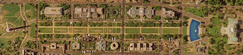
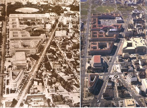
Illustrations respectively from satellite and from http://www.arch.virginia.edu/dcplaces/paave/Segment2/segment2.html

Promenade: n 1: a formal ball held for a school class toward the end of the academic year [syn: prom] 2: a public area set aside as a pedestrian walk [syn: mall] 3: a square dance figure; couples march counterclockwise in a circle 4: a march of all the guests at the opening of a formal dance 5: a leisurely walk (usually in some public place) [syn: amble, ramble, saunter, stroll, perambulation] v 1: march in a procession; "the veterans paraded down the street" [syn: parade, troop] 2: take a leisurely walk; "The ladies promenaded along the beach"

Avenue: N: a wide street or thoroughfare [syn: avenue]

Boulevard: n 1: a line of approach; "they explored every avenue they could think of"; "it promises to open new avenues to understanding" 2: a wide street or thoroughfare [syn: boulevard]

The term Boulevard is being used interchangeably to describe what we would colloquially know as an Avenue and a Promenade.

One example: this letter by National Capital Planning Commission Deputy Executive Director MARCEL ACOSTA, published in The Washington Post Letters to the Editor section, March 27, 2006:

Marcel Acosta, AICP, is senior vice president of planning and development for the Chicago Transit Authority, the nation’s second largest public transportation system. In this capacity, he oversees the agency’s strategic planning, market research, service development, schedules, operations planning, and facilities development efforts. His efforts focus on rebuilding ridership and increasing customer satisfaction Loeb Fellowship, Havrvard University School of Design 2000 http://www.gsd.harvard.edu/professional/loeb_fellowship/alumni/class_2001/acosta.html

In his March 16 Metro column, "South Capitol Street Will Have to Play Catch-Up," Marc Fisher said that one needs a good imagination to see a transformed South Capitol Street.

For more than 10 years, beginning long before anyone dreamed of a baseball stadium being built near the Anacostia River, the National Capital Planning Commission envisioned South Capitol Street as a magnificent boulevard that would befit such a prominent location.

Last year our South Capitol Street Task Force unveiled its vision for transforming the neglected street into a grand urban corridor and waterfront gateway, offering spectacular views to and from the U.S. Capitol. The area would have plazas, parkland, national monuments, commercial and residential uses, and a new Frederick Douglass Memorial Bridge.

We are working with the D.C. Transportation Department, the D.C. Office of Planning and the Anacostia Waterfront Corp. to turn this vision into a reality, and we are delighted that the stadium will help jump-start the transformation.

MARCEL ACOSTA

Deputy Executive Director

National Capital Planning Commission

Why not describe the 1990s NCPC "vision" for South Capitol Street -- as represented by its main publication at that time (1997) "Extending the Legacy: Planning America's Capital for the 21st Century" -- as a "Promenade", and the subsequent plan as an "Avenue"?

Other surface streets of comparable width in Washington, DC are called "Avenues", such as New Jersey Avenue, New York Avenue, Pennsylvania Avenue. Or, generally though not neccessarily for narrower ones, Streets, such as East Capitol Street, hence, simply call it South Capitol Street, with 15’ extra building setback for wider sidewalks. Who uses the same single word for describing a surface street and for describing the National Mall?

Describing these two seperate choices with the same word does not adequately convey their major differences, and misleads by suggesting that the differences are not worth mentioning.

Who thinks that's a good idea for using the same word to describe the National Mall and New York Avenue (135' total width right of way) or Pennsylvania Avenue (160' total width right of way)?

This Marcel Acosta letter is only typical with the style of "reporting" regarding South Capitol Street related developments.