Friday, July 21, 2006

March-April 2008 must be a historically important date

By yet another such indication, Major League Baseball Inc. insists that its blot upon the
Extending the Legacy South Capitol Mall concept be completed in time for the opening of the 2008 season.

From Jacqueline Dupree:
MLB Says DC in Default on Lease Agreement

(7/21 11:41 AM) New from the Post: "Major League Baseball has declared the District government in default of the lease agreement for the new stadium, charging that the city has failed to meet several deadlines for turning over critical documents.In a letter to city officials Tuesday, Tom Ostertag, a lawyer for MLB, said the city had failed to meet 11 provisions called for in the construction administration agreement between the District and MLB." What does this mean? "Some city officials interpreted the default notice as a legal maneuver meant to establish firm deadlines in case the stadium project ever ends up disputed in the courts." Quoth incoming Nats president Stan Kasten: "We're doing all we can to build this team and to excite the fans again about life at RFK. And we're having trouble getting the simplest things done. We keep getting foot-dragging. . . . It does weight us down as we try to move forward. And we keep getting silly roadblocks that stop us." On the other side: "Mark H. Tuohey, chairman of the D.C. Sports and Entertainment Commission, said lawyers for the city's attorney general's office are working on finalizing more documents to give MLB and that most of the baseball's concerns would be resolved today." UPDATE, 3:03 pm: Here's the official notice from MLB. UPDATE, 12:24 pm: Here's a nifty opinion piece by the Post's Steve Perlstein basically telling both sides to get a grip: "Less Hardball, More Humility." And here's the WashTimes story on the default.
Looks like that those D.C. City Coucilpersons that voted in favor of this planning blot may get to eat crow. And to think that the D.C. City Council had voted to reject this blot, only to reconvene towards midnight to re-vote in favor of this blot.

Is it any wonder that the Councilpersons who ultimately voted to approve this blot are not too favorable of requirements that such meetings be open to the public; perhaps they would be embarrassed to be seen making such decisions with such little open discussion.

Perhaps their arms were twisted because some rather influential person somewhere in this story who has this blot as his or her dream, but who has some sort of incurable disease and hence the project deadline is in order for this person to see his or her's dream while he or she is still alive? Someone who may not live to see 2009.

Who knows?

Thursday, July 20, 2006

The Logic of the 2002-2004 South Capitol Mall Deletion

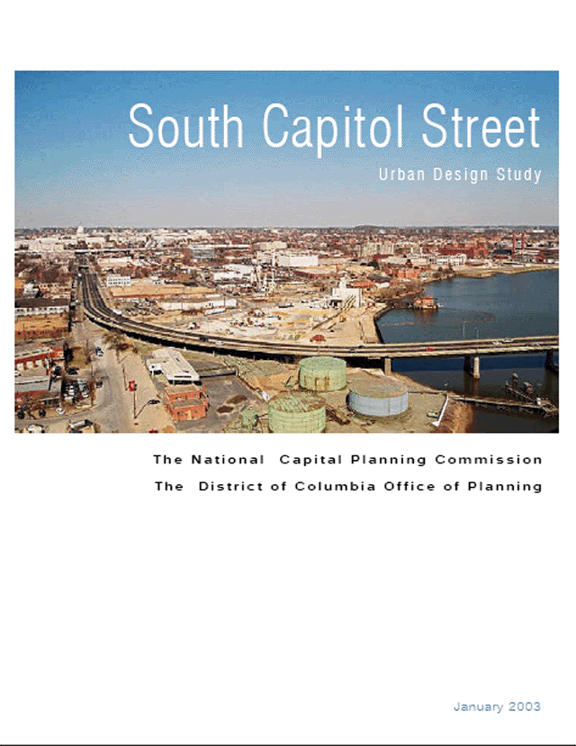
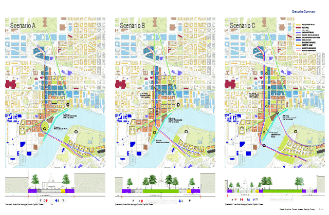
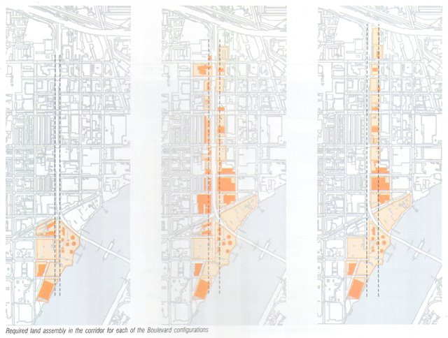
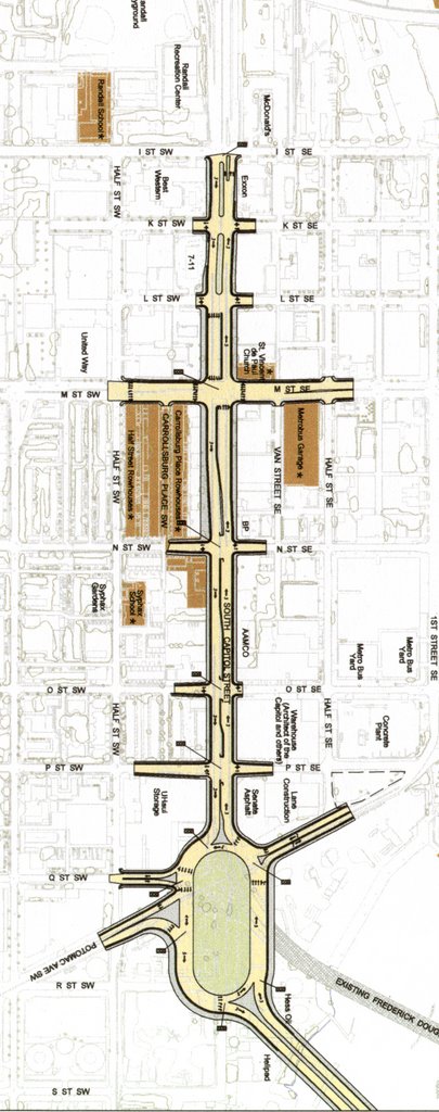
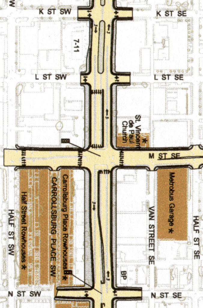
The 2003 studies exclude the basic Mall option for a reconfigured South Capitol Street presented in NCPC's Extending the Legacy and Memorials and Museums. NCPC's South Capitol Street Urban Design Study, did this in response to community outreach meetings in 2002, where people from neighborhoods including those along Carrollsburg Place and Half Streets SW, expressed their sentiment that they did not want to have their dwellings removed for the new parkland and/or the new adjacent buildings. Hence this 2003 report included two drastically scaled back linear park proposals: its options "c" and "b". These had very little property acquisitions to the west, avoiding the Carrollsburg Place and Half Street neighborhoods, limiting residential displacement west of South Capitol Street to directly along that street south of N Street. Because of a dearth of dwellings to the east, options "c" and "b" would have displaced about 5 residences, including the Alfred Richards House that was last privately owned by Ken Wyban, which were demolished in May, 2006. Although this study would cite the need to establish a linear park along the South Capitol Street corridor, it included a 3rd option, “a” that would not widen the right of way, but instead provide a linear park in the form of sidewalks that would be widened by eliminating a parking lane.

To help the authorities decide among these 3 options, the 2003 NCPC South Capitol Street Urban Design Study list the following as their advantages and disadvantages:

For Option “c” with its 195’ wide linear park offset to the east:
Advantages:
New monumental public realm;
Continuity of public realm established between mall and the Anacostia River parks system;
Reinvestment in the area may be attracted by the appearance and the scale of the new South Capitol Street environment.
Disadvantages:
Substantial land takings required east of South Capitol Street;
Most complex and costly of the three to implement;
Requires negotiating with Navy to allow crossing to take most southerly location.
For option "b" with its 220' total right of way with a 100' wide median greenway:
Advantages:
Central median can accommodate series of smaller memorials;
Continuity of public realm established between mall and the Anacostia River parks system;
Reinvestment in the area may be attracted by the appearance and the scale of the new South Capitol Street environment.

Disadvantage
Substantial land takings required including existing housing east and west of the present South Capitol Street ROW.

For option “a” to not widen the existing 130’ South Capitol Street ROW:

Advantages:
Few land takings
Modest adjustments to South Capitol Street
Maximum land for redevelopment

Disadvantages:
Lacks a compelling vision for South Capitol Street
Few opportunities along corridor for memorials, etc.
Limited incentive for additional investment.
By choosing option “a”, the authorities valued an opportunity for extending the monumental core as less important then not infringing upon maximizing the sheer amount of square footage for new real estate development: squandering a unique opportunity for the more mundane by this above criteria. By their admission they selected the option that “lacks a compelling vision for South Capitol Street, in order to minimize property acquisitions for expanding a public right of way, so as to maximize real estate development square footage, while ultimately preserving only one building: St. Vincent de Paul Roman Catholic Church.

Curiously it calls option “c” as most complex and costly, despite the space it provides for a cut and cover tunnel alongside South capitol Street, being the easiest to construct while maintaining the existing South Capitol Street traffic.

This charge of being “most complex and costly” ignores the reality that the buildings along this right of way for the tunnel beneath essentially the eastern half of NCPC’s 1990s through 2001 South Capitol Mall concept, are being cleared anyway, with the sole apparent exception of the St. Vincent de Paul Church. Look at what's happening along South Capitol Street's east side now, in 2006, with demolition for Nationals Stadium clearing every building from Potomac Avenue northward to N Street demolished May-June 2006; and threatening the storage building northward to M Street for a new development project by Monument Reality that may or may not conflict with the Urban Land Institute’s 2003/NCPC’s 2005 proposal for a “town square” at the intersection of South Capitol and M Streets, with additional development projects envisioned for the open parking lots and the McDonalds fast food restaurant northwards from the St. Vincent de Paul Church, which is the sole structure blocking this east-offset tunnel route to the ramps to the SW/SE Freeway.

This charge of “most complex and costly” fails to distinguish between the offset to the east linear park and the tunnel beneath, hence avoiding any consideration of running the tunnel directly under South Capitol Street, with any substantial linear park truncated to go no further north of M Street to avoid a conflict with a position of not demolishing, deconstructing or even relocating St. Vincent de Paul Church. After all, this Church would be the only structure in the path of the offset to the east tunnel and linear park of option "c".

All of the 2003 and later planning documents AFAIK but NCPC’s 2005 report reflect this by showing St. Vincent de Paul Church in its existing location. This includes the November 2002 stadium study where the Nationals Stadium site appears as the mis-named "M Street" option, as well as the Passonneau and Associates illustration that Joseph Passonneau included in his August 2000 slide show presentation at the National Building Museum.

Wednesday, July 19, 2006

Without Debate

From Jacqueline Dupree, Near Southeast Washington:

Council Passes Stadium Parking Plan Without Debate
(7/11 8:12 PM) More to come when news stories are posted, but I can report that the city council today passed without debate PR 16-852, the resolution to sell some of the stadium property right along N Street to developer Herb Miller, so that he can build not only the 925 parking spaces required by MLB but also a mix of residential, retail, and hotel offerings. (Without debate! Will wonders never cease!) Now the real fun begins, seeing whether he can actually pull this off on schedule and on budget. While it's quite a gamble, I don't think there's many residents who would have preferred two aboveground parking garage-boxes rather than mixed-use offerings in this location. Now we'll just see whether the gamble pays off. Batter up, Herb. UPDATE: here's the Post story, including that news that Miller "intends to produce the first $5 million or $6 million [of financing] in September to start excavation of the land, and the bulk of the financing would come by Dec. 1." UPDATE, 9:48 am: And here's the WashTimes story. UPDATE, 7:39 pm: And a late addition, this Examiner story says what I've suspected all along: "In its unanimous support of developer Herb Miller's project, to be built on two city-owned parcels adjacent to the ballpark's north end, the council sent a message, members said: Major League Baseball has long had the city over a barrel, but not in this case. " 'It's the first time the council has stood up and said, "This is ours," said Ward 5 Council Member Vincent Orange. "These are our development rights." ' "
Alas this is has been hardly uncommon with the planning for the South Capitol Street corridor itself, with no evident open debate or even an explicit discussion about the deletions of proposed linear parkland, the existing residential neighborhoods to the west, and the role or impact regarding St. Vincent de Paul Church at the northeast corner of the intersection of South Capitol and M Streets.

Monday, July 10, 2006

What could be done instead:
Improve RFK area accessibility


While RFK already has a relatively adequate WMATA stop, (in contrast to the South Capitol Street area), Washington, D.C. has a seriously truncated highway system that has yet to be completed, and which falls short of serving the RFK area. Hence, in contrast to the official planning which pretends to provide for a multi-model and comprehensive transportation network, the focus here is on providing the missing segments of highway.

Extend the SE Freeway Barney Circle Underpass to East Capitol Street, taking advantage of the topography to build a cover over the existing SE Freeway to the west towards the 11th Street Bridge[s], and over the extension to the east, this placing most vehicular traffic underground beneath new parkland and a local slow speed road with a new terrace to the waterfront, extending the Washington, D.C.'s monumental core beauty along the Potomac River by the Lincoln Memorial to the Anacostia River.

The topography allows this underground SE Freeway to be constructed relatively inexpensively without excavation for the entire segment that follows the axis of the Barney Circle Underpass since this highway runs across a hill; the segment towards RFK/East Capitol Street would be a cut and cover tunnel through existing right of ways and parking lots. The most challenging portion is the transition between these two segments at the southeast corner of Congressional Cemetery.

This would not build the Barney Circle Bridge that was officially proposed from 1983 to 1996.

The current Middle Anacostia Transportation Study hints at this idea of such a topographically advantageous cover for the existing SE Freeway segment as a tunnel without any new excavation; it does so with various cross-section illustrations, accompanied by a total lack of any acknowledgment of this idea, with the space simply labeled "development".

This study shows different options, including those that abandon even the existing Barney Circle Underpass, and those that drastically reduce the public right of way by selling off much of the existing SE Freeway right of way for new private real estate development.
Extend a covered – tunnel – SE Freeway to RFK, topped by a new monumental terraced waterfront promenade and surface road


Between the 11th Street Bridges and Barney Circle, the westbound traffic capacity of the SE Freeway is underutilized while its eastbound capacity is bottlenecked by the SE Freeway’s truncation at Barney Circle and its consequential diversion of traffic across the Pennsylvania Avenue/Sousa Bridge to the incomplete interchange with the Anacostia Freeway, which runs along the continuous length of this south or east side of the Anacostia River, reducing local access to the adjoining neighborhoods, such as Hillcrest.

Failing to extend the SE Freeway to RFK Stadium diverts traffic from the truncated SE Freeway on the west side of the Anacostia, to a bridge to the east side of the Anacostia River places a disproportionate proportion of the traffic burden on the neighborhoods It does protect local accessibility along the waterfront area of the Anacostia west shore in the area around Congressional Cemetery, part of which is now lined by a surface RR, but it reduces the SE Freeway’s utility, while doing nothing to remove the local barrier effect of the existing SE Freeway segment to Barney Circle’s west, nor those of the fully continuous I-295/DC Route 295 Anacostia Freeway on the other side of the river.

Best serving the principle of environmental justice would be to protect and promote these concerns broadly and fairly, with equivalent environmental mitigation for neighborhoods on both side of the Anacostia River translates to both reconstructing existing freeway segments with improved designs that feature greater operation ability, safety and environmental mitigation, particularly tunnels to contain noise, air pollution and run-off such as brake dust, with such standards applied to extending the SE Freeway to RFK Stadium.

RX:

West of the Anacostia River

Extend a tunneled SE Freeway to RFK stadium/East Capitol Street, doing this relatively good economy of scale via taking advantage of the topography to avoid the significant expense of excavation for much of the route, and with significant local benefit in improving RFK area accessibility, with a new highway cover that would essentially serves as an western and an eastern extension of the current island of Barney Circle.

The existing SE Freeway could be made into a tunnel with its full capacity with building such a cover west to the point where the ramps to and from RFK Stadium ascend to the 11th Street Bridges (with these ramp connections being retained in what ever redesign that may occur with the 11th Street Bridges).

So could the freeway extension through and to the east of the Barney Circle underpasses for the ¼ mile or so it would pass paralleling the boundary of Congressional Cemetery and the RR, with a full cover featuring a terrace to the waterfront. It could be so designed with a cover to skirt around the southeastern edge of Congressional Cemetery (or it could conceivable cut beneath its edge); and it would require excavation only for the northern portion if it is to turn a bit away from the waterfront to instead run more through the existing parking lot areas, and covered to serve the local environment and accessibility.


Illustration: SE Freeway topographical cross section.

Any project to reconstruct the 11th Street Bridge must maintains ramp connections from its north end to and from RFK Stadium. Eliminating these ramp connections would deny a direct I-295 connection, diverting such traffic further east to the East Capitol Street Bridge, or up a South Capitol Street that lacks a ramp connection to the SW Freeway, hence forcing traffic instead through residential surface streets.

Reconstruct SW/SE Freeway underground, with project to include completely depressing and covering the entire SW Freeway to South Capitol Street, and the SE Freeway from there east to 7th Street SE.

Address the SE Freeway west of the 11th Street Bridges and the SW Freeway, even though these segments will be considerable more expensive per lane mile, as they will carry relatively great amounts of traffic over relatively short distances. Both will be more expensive to tunnelize, because rather than simply building a cover over an existing highway or its extension along a ridge with little or no major excavation, this involving removing a viaduct and building an all new cut and cover, perhaps with some drilled tunneling, but definitely requiring some cut and cover ultimately for transitions to the surface. Also, because portions of this freeway run along or cross over a generally paralleling RR, this reconstruction must accommodate this RR’s future. With the requirements of minimizing the construction project footprint and of maintaining SW/SE Freeway traffic flow throughout the construction itself, the new tunnel roadways would have to be constructed to take advantage of the greatest existing open spaces within the 70 or 80 feet immediately along the SW Freeway’s southern edge.

This mostly or entirely avoids displacing any dwellings to the east of 7th Street SW, just south of the headquarters of the U.S. Departments of Transportation and of Housing and Urban Development, and confines such displacement to a row of 28 luxury townhouses built in 1999 a mere 16 ½ feet from the SW Freeway retaining wall.

Further west the construction would temporarily take the northern edge of the Banneker Knoll, which would be subsequently restored. This Banneker knoll area is particularly crucial regarding any ideas presented for helping to better locally connect SW, and the National Mall and the Jefferson Memorial with the Hanes Point Park, with these areas being separated to no insignificant degree by the 14th Street and I-395 roadways. It is important because it provides the space for reconstructing the SW Freeway in a truly comprehensive manner: not only burying it with superior safety and capacity operation ability as the newly staged parallel roadway would permit additional lanes to the I-395 Center Leg (3rd Street Tunnel), but also extending the under grounding further west to reconnect the area around the Jefferson Memorial, eliminating the massive elevated roadways that now obstruct the site lines such as that along G Street SW, while relocating the highway and where it would emerge to meet its spans crossing the Potomac River a bit further away to the south, perhaps to a new traffic circle centered on 14th Street. This would be done as part of a project to remove and replace the existing 14th Street and I-395 Bridges, and the existing RR, including perhaps a new tunnel for WMATA. Current planning for that area irresponsibly places buildings too close to the existing highway.

Any planning for a building atop this right of way must accommodate this to minimize wasteful demolition which would far exceed that of the 28 EYI “Capital Square” townhouses along the SW Freeway’s retaining wall.

East of the Anacostia River

Adopt the concept of reconstructing the Anacostia Freeway with design improvements including depressing and fully covering over significant segments, for maximizing environmental mitigation, with design capacity for additional and future capacity with better economy of scale, with the design and the placement of the submerged retaining walls.

Include continuous merge lanes and at least one additional lane per direction in the mainline, plus the space for an immediately parallel depressed/coverable roadway to provide the flexibility for the future (such as a cross Potomac Tunnel to the Shirley Highway, Virginia 110 and a Route 1 bypass via Potomac Yards). Design this to serve the parallel RR and its future, including that as an already planned location of a Light Rail Line (LRT). Designing submerged retaining walls to support a lid converting depressed highway into a full tunnel, and to serve a parallel underground transit-way are duel principles embodied by Cincinnati, Ohio’s Washington Way reconstruction project.

Be sure that any design for portions of the Anacostia Freeway to be underground, either as part of the initial project, or staged with a below grade highway with retaining walls designed to support a lid as a tunnel roof.

These concepts can be applied to portions of the Anacostia Freeway northeast past Pennsylvania Avenue, particularly the area around East Capitol Street with an idea of improving access locally and regionally, with a covered interchange between the Anacostia Freeway and East Capitol Street, and with extending the reconstruction to the interchange with Maryland Route 50 and the Baltimore-Washington Parkway, while extending the design of the monumental core parklands to the east.


And On Both Sides of the Anacostia River:

Build an all new bridge across the Anacostia River connecting Massachusetts Avenue SE. Build this bridge primarily or exclusively as a local traffic bridge without connections to the freeway extension east of Barney Circle to RFK (in part due to the close spacing between the interchanges with East Capitol Street and Pennsylvania Avenue. This would be compatible with the officially envisioned redevelopment of the D.C. General site, and with the southern portion of the East Leg covered. But it would have been blocked by the Barney Circle Connector Bridge that was formally proposed in 1983 and cancelled in 1996.

Sunday, July 09, 2006

What could be done instead:
Develop RFK area


Air rights platforms over swaths of the existing parking lot areas would preserve parking capacity while providing new space for new developement, either with little or no excavation.

Air rights platforms over the below ground SE Freeway/Barney Circle Underpass extension in the area around Massachusetts Avenue

Up front purchases of some areas of existing residences which would be replaced with new development that would include replacement dwellings for any such displaced residents who prefer to remain in the same local area. This would not use eminent domain, as it falls outside the traditional understanding of the U.S. Constitution's scope for its use for public purposes, such as roads, parks and government buildings, but not for more private uses as redevelopment. Instead, it would use financial inducements, perhaps 3 X market value.

If used for an extension of the existing East Capitol Street Plaza, this would show a popular appreciation for acquiescing to a public right of way.

What could be done instead:
Enlarge RFK via an Outer Ring


What Others Are Saying

Hysterical baseball rush: Ignoring RFK enlargement

The Hill News
Duncan Spencer

http://www.hillnews.com/thehill/export/TheHill/Features/Hillscape/101304.html

The thought that keeps reoccurring: Why not play at RFK? Permanently.

When Jack Kent Cooke wanted to build a new stadium for the Redskins, using part of the vast parking area out there between Eastern High School and Kingman Island, sensible voices were raised to urge the cheaper and simpler solution. To enlarge RFK.

That’s right. A local architect, since moved to Frederick, Md., testified to the City Council that enlarging RFK would be relatively inexpensive, could be done quickly, by adding another tier of seating (a second circle around the already circular structure), and could be done without demolishing the present playing field — in a single off-season.

Thursday, July 06, 2006

What the 2003 South Capitol
Urban Design and Gateway
studies would have done:


2003 NCPC South Capitol Street Urban Design Study


http://www.ncpc.gov/publications_press/s_cap/part_1.pdf
http://www.ncpc.gov/publications_press/s_cap/part_2.pdf
http://www.ncpc.gov/publications_press/s_cap/part_3.pdf

Published February 2003. NCPC press release July 2003. Presents 3 options:

"C" 325' total right of way with 195' linear park offset east

"B" 220' total right of way with 100' median park

"A" 130' total right of way with wider sidewalks created by eliminating one lane per direction.

Option "C" roughly represents the eastern half of what appears in 1997 and 2001. Obstensibly this was done to avoid property displacement to the west, such as the neighborhoods along Half Street and Carrollsburg Place SW.

All include a 6 lane vehicular tunnel, with "B" and "A" placing it directly under South Capitol Street, and "C" placing it to the east beneath the 195' wide linear park.

Of the options themselves:

Options "C" and "B" displace St. Vincent de Paul Church from its existing location

Option "A" does not.

Option "C" displaces only 4 residences (since demolished for the stadium)

Option "B" displaces 34 residences along west side of South Capitol Street between O and P Streets

Option "A" displaces no residences, and has the stated advantage of not requiring property acquisitons.


According to a June 5, 2003 NCPC press release:

The key urban design principles outlined in NCPC’s study include:
  • Create a great urban boulevard that serves local neighborhoods as well as regional and national visitors.

  • Establish a linear park along the length of a new South Capitol Street that will connect the Mall and Capitol Hill with the Anacostia River.

  • Create a great civic space on both sides of the river where South Capitol Street meets the Anacostia River.

  • Improve local and commuter traffic flow and create a ceremonial approach to the Capitol Building from the Suitland Parkway.

  • Replace the existing Frederick Douglass Bridge with a more beautiful and memorable gateway to Washington’s Monumental Core.

  • Align the new river crossing to minimize highway ramp infrastructure and provide greater flexibility for future development on Poplar Point.

  • Strengthen existing neighborhoods within the corridor, along New Jersey Avenue, and on Buzzard and Poplar Points.

Nonetheless, an NCPC press release dated May 20, 2004 would recommend option "A".
  • Create a surface roadway that retains the street’s current 130-foot width and provides additional space for parks, memorials, and pedestrian amenities along its length;

http://www.ncpc.gov/publications_press/Press_Releases/2004/pr052004.html

The additional space would be provided by eliminating one vehicular traffic lane per direction to allow widening the sidewalks. Eliminating these traffic lanes was said to be be allowable by the includion of the 6 lane tunnel beneath or alongside South Capitol Street to connect I-295 with I-395 that appears in all 3 options.

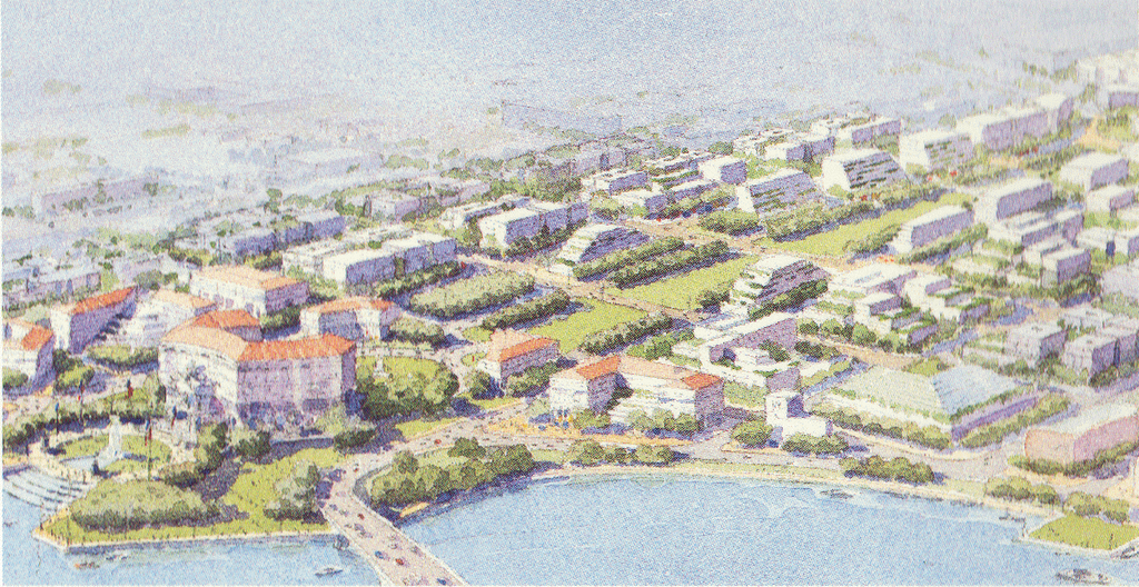
This does not neccessarily guarante against such displacement from adjoining development. The isometric renderings below show ALL of these options, including "A", accompanied by new adjoining development that displaces the residences on the west side of South Capitol Street, plus an unclear amount further west.


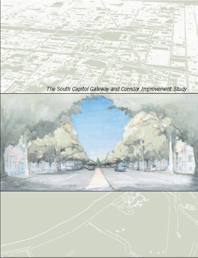
2003 DCDOP South Capitol Street Gateway Study

http://ddot.dc.gov/ddot/cwp/view,a,1247,q,560731.asp

http://ddot.dc.gov/ddot/frames.asp?doc=/ddot/lib/ddot/information/documents/frames/south_capitol/pdf/sc_cover.pd

Only the above option "A" appears.

Shows St. Vincent de Paul Church in its existing location.

Wednesday, July 05, 2006

What Extending the Legacy
and Memorials and Museums
would have done:


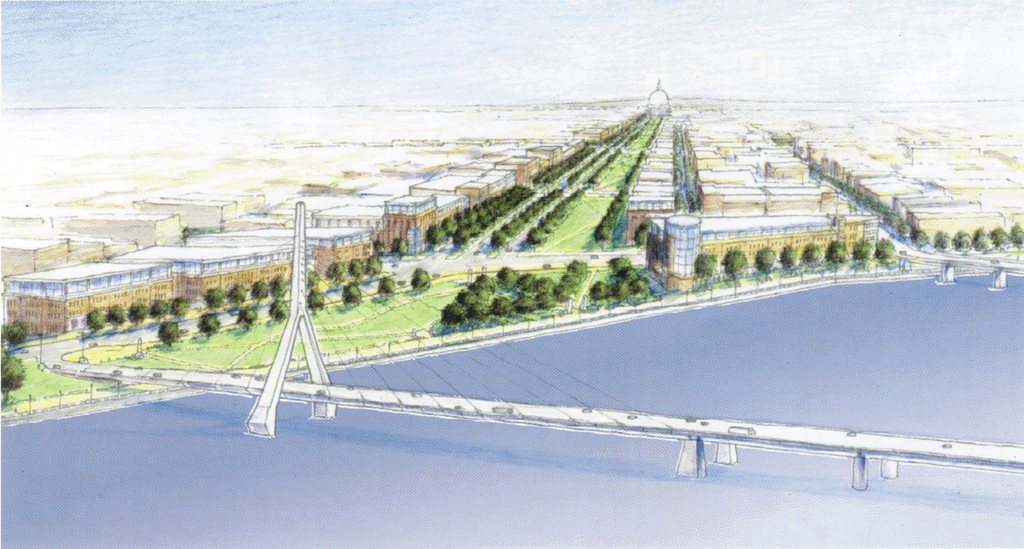
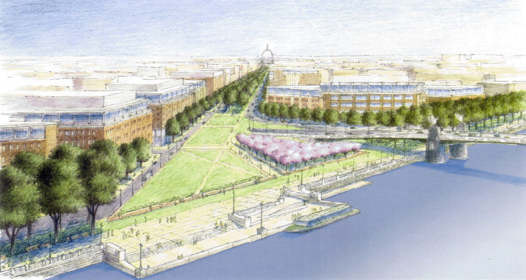
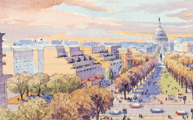
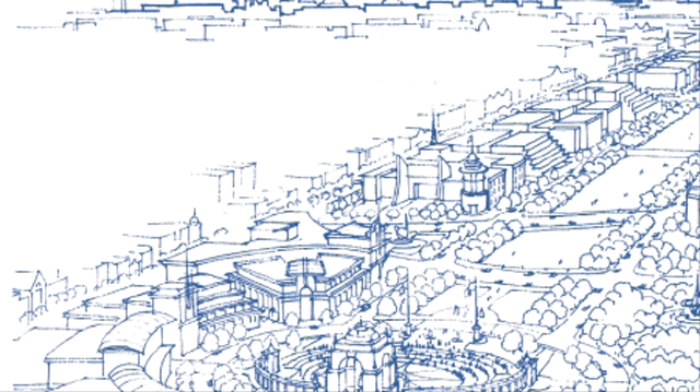
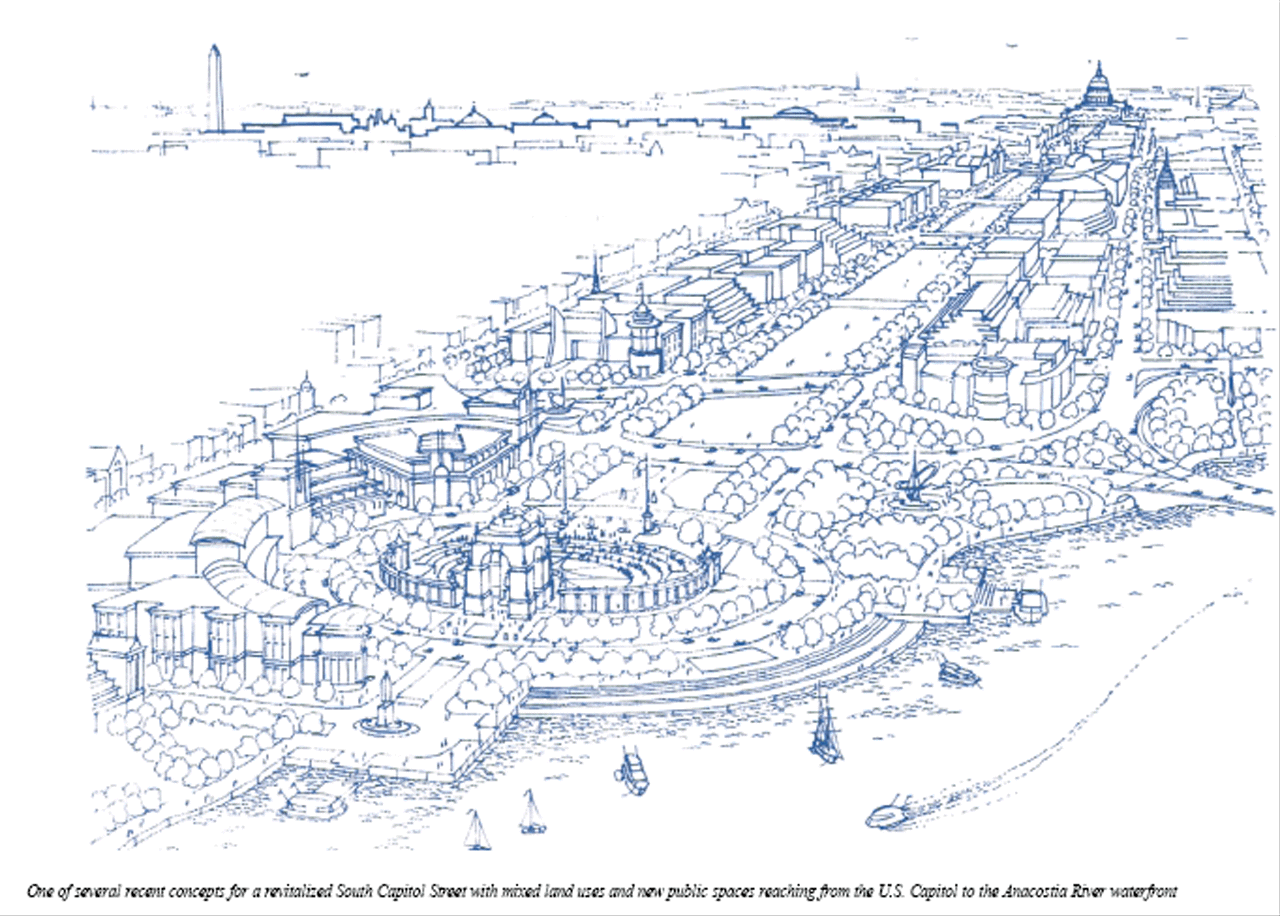
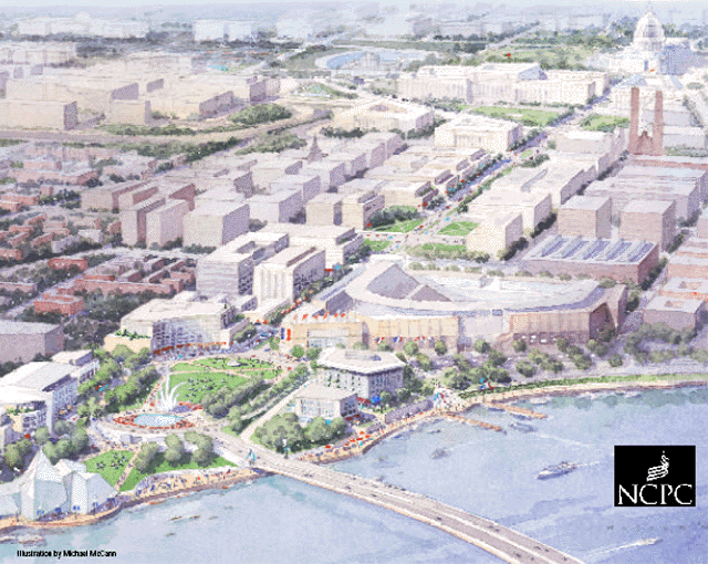
>Illustration: NCPC 1997 Extending the Legacy with St. Vincent de Paul Church gone, either demolished or relocated to a site away from the South Capitol Street are, and with new buildings replacing it and all of the other extsting buildings on South Capitol Street's east side, and easterly to 1st Street SE.


Illustration: NCPC 1997 Extending the Legacy with new buildings replacing those along South Capitol Street's west side, westerly to 1st Street SW.

The illustrations below show a tower at M Street suggestive of the idea of relocating St. Vincent de Paul Church about 250 east to accommodate the South Capitol Mall


Illustration: September 2001 NCPC Memorials & Museums;
shows tower at M and Half Street SE suggestive of a relocated St. Vincent de Paul Church


Illustration: NCPC September 2001 Memorials and Museums with new buildings along each side of South Capitol Street replacing all of the existing buildings in area between and adjacent to 1st Streets SW and SE.

This would have for public park land and new buildings possibly including new public buildings as museums.

The new buildings would provide sufficent opportunity to replace the existing dwellings to allow the current inhabitants to remain in the neighborhood.

The few buildings of better quality style, such as the Alfred Richards House that was last owned by Ken Wyban, and demolished during the 4th week of May, 2006, could have been relocated short distances, such as with relocating St. Vincent de Paul Church 250 or 500 feet due east.

I do not know why the 1990s "Extending the Legacy" plans did not show St. Vincent de Paul Church at all, since it's clearly an architecturally worthy building to save.

Tuesday, July 04, 2006

And the Space for the Church?


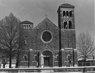
St. Vincent de Paul Church
(above- Washington Archdioces;
below- Jacqueline Dupree)


Looking north with U.S. Capitol building to left

Monday, July 03, 2006

And the space along Carrollsburg Place and Half Street SW?


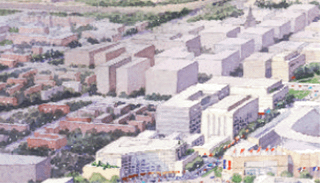
Illustration: crop of NCPC March 2005 rendering showing new buildings west of South Capitol Street to east side of Half Street, immediately next to residential neighborhoods further west.

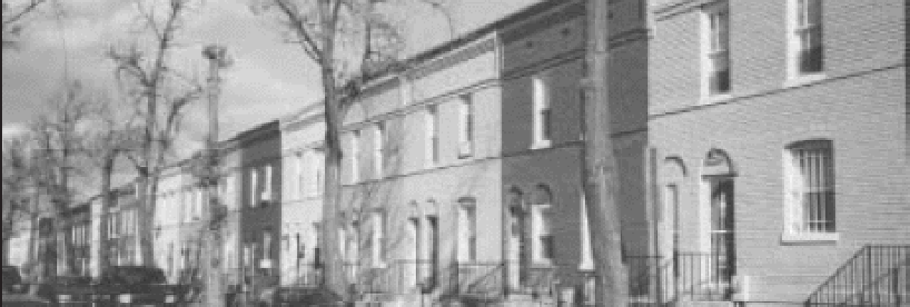
Illustration: Residential dwellings along Carrollsburg Place SW, south of M Street.
http://www.swdc.org/news/Southwester_JAN_2004.pdf

Also, see: http://
www.swdc.org/news/Southwester_MAY_2006.pdf

According to the November 2003 Urban Land Institute “An Advisory Services Panel Report: South Capitol Street Corridor, Washington, D.C. Implementation Plan”

http://www.ncpc.gov/publications_press/s_cap/SCapitolStReport.pdf

This challenging area, currently home to a large concentration (907 units) of public housing and a high percentage of the 60 public housing projects located in or near the study area, also includes industrial uses and warehouses of low value. Market pressure on the Southwest waterfront is encouraging the development of more middle-income residential neighborhoods near the water; while more distant properties, located closer to the intersection with South Capitol Street, remain the domain of public housing. No successful redevelopment of the District's Southwest can be accomplished while ignoring the incompatibility of this use with the desired future market.

Current residents of this housing stock must be offered incentives to relocate over time in mixed-income housing developments such as the Capper-Carrollsburg HOPE VI project on M Street, east of South Capitol Street. This can and should be accomplished with no net loss of public housing units, while increasing affordable housing choices for low-income residents. Capper-Carrollsburg will incorporate residential and street-level retail, with densities highest along South Capitol Street, and decreasing as development moves in a westerly direction. Re-densification of the area between R and M Streets can accommodate a far greater range of income demographics then is present today, providing a residential environment that supports the overall development of So Cap.

The SoCap area is presented with the unique opportunity to provide a wide range of residential opportunities, from mixed-income to the highest priced, high density living. SoCap has the potential to become a seamless neighborhood, free of the barriers of race and income that now defines it. Inclusionary zoning, tax benefits, and small business initiatives will encourage the provision of street-level retail throughout the area. Future mixed-use, high income residential properties lining South Capitol Street cannot be allowed to become canyon walls between the communities of SoCap and the boulevard.

Providing living opportunities within walking or light rail distance of office and retail/entertainment will be increasingly important to those who wish to enjoy an urban lifestyle. Office uses in SoCap’s southeast quadrant will generally be confined to the corridor along South Capitol Street and perhaps along M Street and the Anacostia River. However, the predominant uses in this quadrant will be residential and convenience retail, and potential institutional uses such as education. (pp 15-16)
The text does not state any western limit of this new redevelopment in SW.

But do be sure to check out the illustration at the lower left of page 16: "Market potential in sub areas" .


For it shows a great much of SW as "Available for Development".


Sunday, July 02, 2006

The Corridor


Space for the town square?

This is a close up crop of the illustration of the future South Capitol Street from U.S. National Capital Planning Commission's March 2005 South Capitol Street, showing the proposed "square" at the intersection with M Street.


2005 NCPC South Capitol Street Grand Urban Boulevard and Waterfront Gateway

http://www.ncpc.gov/publications_press/s_cap/NCPC_SouthCapitolSt.pdf

This is inconsistent with the appearance of this concept of a South Capitol Street Square at M Street in the November 2003 Urban Land Institute Advisory Services Panel Report, which shows this square with the St. Vincent DePaul Church in its existing location, and with the text explicitly endorsing this. (It also shows the residences to the west retained, immediately adjacent to new development. However, its text expresses this as a temporary situation, stating that the existing neighborhoods are incompatible with the new development and that the existing residents should be encouraged to move.)

Inconsistent with either version of this "South Capitol/M Street Square" would be the announcement of a major real estate development project in any of the other three remaining quadrants, with no indication of a building line set back that I have seen to accommodate the "Square".

But take a look at this:


And this:

And this:

So where's the square?

And exactly what's up with the "Square’s" south east quadrant: 1200 South Capitol Street?

This approximately 9,000 square foot property, currently occupied by Dominos Pizza, was recently purchased by Monument Reality LLC part of $28 million in stadium area acquisitions.

From Jacqueline Dupree: June 13, 2006
http://www.jdland.com/dc/staddis.cfm
• Monument Realty Signs (6/13/06 06:19 PM)
Within the past few days, a series of bright yellow signs have appeared along N Street and Half Street, across from the northern edge of the ballpark site--the signs are all from Monument Realty, which has spent nearly $40 million buying property to build nearly 750,000 sq ft of mixed-use offerings as part of the Ballpark District (not the area on the stadium land that the parking garage squabble is endangering, but the two blocks between N and M and South Capitol and 1st). The signs have big baseball-related slogans on them, like "Play Ball!", "Heavy Hitter", "Home Run" and so on, and then the Monument Realty name and logo, but no information on what's coming. A Post article from March did quote Monument as saying that they plan to begin construction in early 2007, so perhaps we'll hear details before long.

The url for Monumental Reality is

http://www.monumentrealty.com/

So far, I have not found any illustrations.

Saturday, July 01, 2006

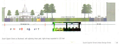
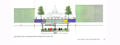
The Tunnel with
or without a Linear Park

With:


Without
:

These illustrations are from the 2003 South Capitol Street Urban Design Study (NCPC) and the Urban Gateyway Study (DCOP).

2003 NCPC South Capitol Street Urban Design Study

http://www.ncpc.gov/publications_press/Press_Releases/2003/pr060503_2.html

http://www.ncpc.gov/publications_press/s_cap/part_1.pdf
http://www.ncpc.gov/publications_press/s_cap/part_2.pdf
http://www.ncpc.gov/publications_press/s_cap/part_3.pdf

2003 DCDOP South Capitol Street Gateway Study

http://ddot.dc.gov/ddot/cwp/view,a,1247,q,560731.asp
http://ddot.dc.gov/ddot/frames.asp?doc=/ddot/lib/ddot/information/documents/frames/south_capitol/pdf/sc_cover.pd

The version above with the linear park was for essentially the eastern half of the 1997 Extending the Legacy concept, with the western half being ommitted obstensibly to avoid displacing existing residences.

These reports would state a goal of establishing a linear park along the South Capitol Street corrdor. But they would forsake this concept, for the stated reason of avoiding property aquisitions along a swath where most or all of the buildings would be demolished anyway, including that for the western portion of the stadium site that appears in the stadium study that was published in November 2002.

Interestingly, on a time-line, NCPC's abandonment of its linear park concept for South Capitol Street (2003-2004) is framed by this stadium site's appearance in the stadium study published November 2002, and this stadium site's selection public announcement around Septenber 22/23, 2004.