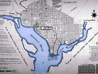
1791: The L'Enfant Plan: named for the French architect, Pierre Charles L'Enfant (born August 2, 1754, died June 14, 1825), established the basic surface road grid and the National Mall west from the Capitol Building to the Washington Monument
 Conforms to regional transportation infrastructure needs by including an open canal along
 Constitution Avenue South Capitol Street
 Conforms to regional transportation infrastructure needs by including an open canal along
 L'Enfant
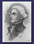
1901: The McMillan Commission: named for U.S. Senator from the State of Michigan, James McMillan (born May 12, 1838- died August 10, 1902).
McMillan
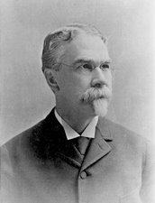
This names its four (4) designers: architects Daniel Burnham (born September 4, 1846- died June 1, 1912), Charles Follen McKim (born August 24, 1847- died September 14, 1909), Sculptor Augustus St. Gaudens (born March 1, 1848- died March 3, 1907), and landscape architect Frederick Law Olmstead (born April 26, 1822- died August 28, 1903).
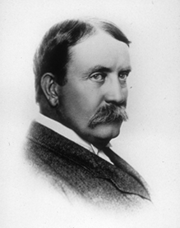


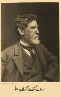
Illustrations: Burnham (top left), McKim (top right),
St. Gaudens (left), Olmstead (right)
It could otherwise be called the Burnham/McKim/St.Gaudens/Olmstead Plan.
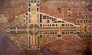
This effort for downtown Washington, D.C. established the western extension of the National Mall via new land fill, with the Reflecting Pool and the Lincoln Memorial and Traffic Circle, which was completed in 1922. This marked what was called the "City Beautiful" approach to urban planning.
It also conformed with transportation infrastructure needs, but with reconstructions making it more friendly for the adjoining areas down-town, replacing the B&O segment across the Mall with a new tunnel starting at a new Beaux Arts Union Station (with its curvature applied to adjacent Massachusetts Avenue NW) and running beneath 1st Street NE/SE, emerging at C Street SE (due to the slope) before entering a covered tunnel along Virginia and Maryland Avenues SW.
It also went beyond the downtown area to include a circumferential road that would link Washington, D.C.'s historic forts.

Illustration: McMillan Commission "Fort Drive"
Various Links:
A Monumental City
http://www.themillenniumgate.org/DChistory.htm
The L'Enfant and McMillan Plans
http://www.cr.nps.gov/nr/travel/wash/lenfant.htm
http://www.savethemall.org/mall/resource-hist02.html
http://www.savethemall.org/mall/resource-hist03.html
Open Space Design in the National Capital Region
http://www.nbm.org/blueprints/90s/fall91/contents/contents.htm
McKim, Mead and White
http://freenet.buffalo.edu/bah/a/archs/mck/index.html


No comments:
Post a Comment