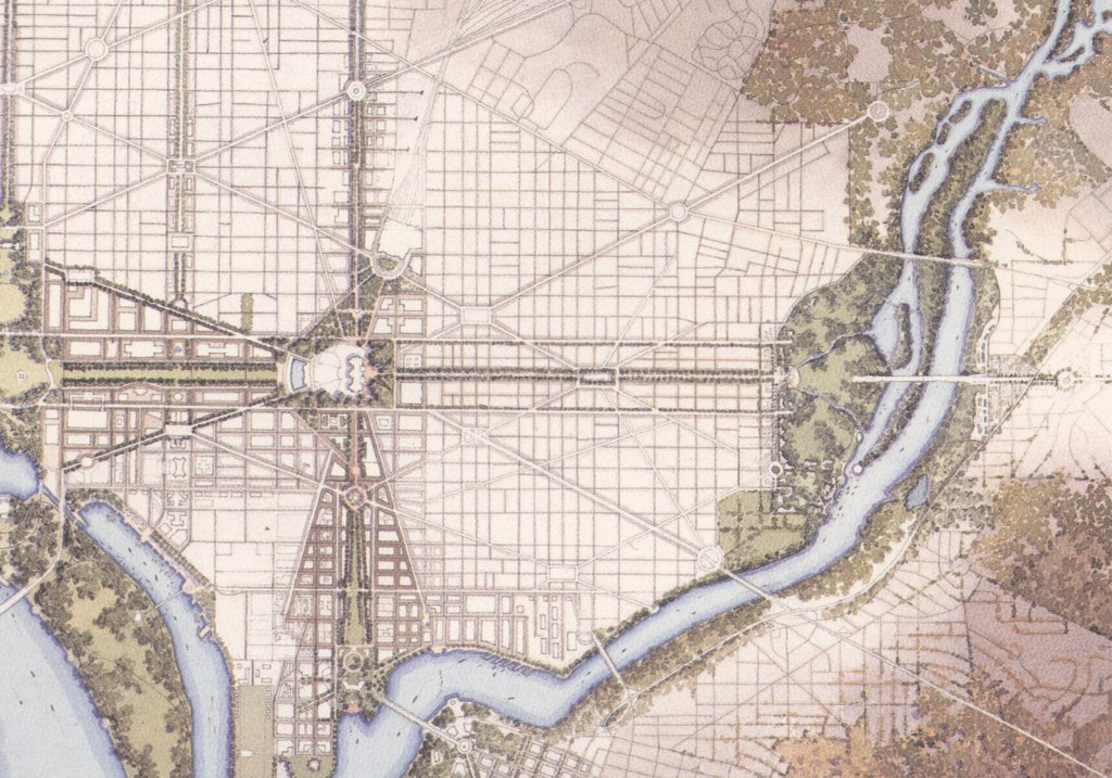
Monday, May 22, 2006

The Core Idea:
emphasizing the main axis while minimizing public land expansion

NCPC's 1997 "Extending the Legacy" builds upon the L’Enfant plan’s main axis of North, East and South Capitol Streets vi building new open public spaces, It does so with a fraction of the residential displacement of unfulfilled 1920s-40s proposals for an East Capitol Street Mall (1000s) or 1955 through the 1970s proposals for an I-95 North Leg East (600+ 1971 design).

North Capitol Street

It primarily rejects widening any of the public right of ways along North Capitol Street; it limits private property acquisitions to dwellings just west of its intersection with New York Avenue for a traffic circle.

It primarily rejects widening any of the public right of ways along North Capitol Street; it limits private property acquisitions to dwellings just west of its intersection with New York Avenue for a traffic circle.


East Capitol Street

Similarly, it rejects widening any of the public right of ways along or parallel to East Capitol Street, avoiding any residential neighborhoods west of the Anacostia River. It limits private property acquisitions to that for a new traffic circle near the Anacostia Freeway.


South Capitol Street

It adopts the alternative of widening the public right of way continuously from a new traffic at the site of today’s SW/SE Freeway viaduct, south to the Anacostia River, widening this 130’ right of way to as wide as 500’ – between Half Streets SW and SE – and tapering (narrowing) to the north.

It would remove every building along existing South Capitol Street, or these, most are industrial/commercial of little architectural virtue, with residences only along its west side, between N and O Streets SW. It would be lined be new buildings that would displace those now between 1st Streets SW and SE, if not the entire area between Delaware Avenue SW and New Jersey Avenue SE.

This would displace 20+ dwellings along the west side of South Capitol Street, plus 200+ further west along Carrollsburg Place and Half Streets SW south of M Street, with 0 dwellings on the east side of South Capitol Street, and a handful further east. The overwhelming number of these dwellings which are to the west, were originally built to house sanitary workers. The handful to the east include one which is better architecturally; located on N Street, it is owned by Ken Wyban. Stadium renderings show it removed. The photograph below was taken in spring 2006 and shows demolition for the stadium.

http://www.jdland.com/dc/stadium.cfm?tab=no2 (Jacqueline Dupree)

(This is also true withOUT the linear park “Mall” for South Capitol Street, as the space is shown occupied by new buildings, such as Nationals Stadium.)

Within this entire footprint, the single most architecturally significant structure is St. Vincent de Paul Roman Catholic Church, which opened to the public in April 1904, located at the northeast corner of South Capitol Street and M Street.

http://www.jdland.com/dc/southcap.cfm (Jacqueline Dupree)

The illustrations in NCPC’s Extending the Legacy show this church removed, either relocated elsewhere or demolished.

No comments: