Friday, June 30, 2006


Room for Tunnel Access & Constructability?

Under the idea of deferring the tunnel, planning relies upon the idea of drilled (bored) rather than cut and cover tunneling: an option that is touted without consideration of soft soil conditions that may significantly increase the construction costs.

But it will still need an area for its inevitably cut and cover transition area for any ramp connections, perhaps at M Street as suggested by at least one of the year 2003 studies, and definitely at its north end with I-395.

Below is a map, created by The Washington Post, of that area's development.
---

Mouse over the numbered lots below for more information. The "'Near Southeast' D.C. Redevelopment" blog maintained by Post intranet editor Jacqueline Dupree also has dozens of photos showing changes in the neighborhood. A printable (PDF) version of this map is here.

area map

Related map:
Tracking the Development of a Neighborhood in Transition (Jan. 27, 2006)

GRAPHIC: Jacqueline Dupree and Nathaniel Vaughn Kelso, The Washington Post; Alyson Hurt and Brian Cordyack, washingtonpost.com - Aug. 15, 2005; updated Jan 17, 2006.

http://www.washingtonpost.com/wp-srv/business/daily/graphics/stadium_081505/

Note the plots at both these areas along South Capitol Street.

The stadium effectively blocks placing the tunnel east of South Capitol Street and west of 1st Street SE, unless it were to go under a portion of the stadium. This is not envisioned as part of constructing this stadium in relatively soft soil conditions quickly enough to open in time for an April 2008 opening. I have not found anything about any possible provisions in any of the building foundations for accommodating a highway tunnel.

Hence, the tunnel would have to either to the east, beneath 1St Street to CSX railroad properties for a continuation to I-395, directly beneath South Capitol Street, entirely or partially or entirely to the west, displacing existing residential dwellings.

If it were to not go to the west, and with planning seeking to eliminate the existing transitions near M Street by St. De Paul Church and Dominos Pizza, by process of elimination and such M Street area tunnel access would likely be along 1st Street SE. The parcels to the north of M Street have new development projects 80 M Street Wells Real Estate Investment Trust, office building completed 2001,First Street between M and L Streets, Faison Associates. The parcels to the south of M Street on the east side of 1st Street SE, ”First and M Streets” Cohen and Camilier families, are listed as a possible 700,000 square foot mixed use development, across a 1st Street from a Southeast Federal Center. One might ask if any of the existing planning studies outline any sort of right of way reservation for a northbound to surface ramp, or a southbound to tunnel ramp anywhere along this block of 1st Street SE between N and M Streets?

Any reference to a planned tunnel alternative as a common element of all three bridge proposals, to use the studies that presented this tunnel, and the reality of the Nationals Stadium, as guides, most likely means the option of an alignment directly beneath South Capitol Street. Together with the goal of eliminating the transitions to the underpass at M Street, this would plausibly translate to this new tunnel having no access ramps around M Streets. This would be regardless whether this South Capitol Street alignment tunnel was built by the drilled or strictly the cut and cover method.

But regardless of the method or the route, any such tunnel will require space for cut and cover segments to connect with I-395, with a design that anticipates a concurrent or future under grounding of the SW/SE Freeway with minimal cost and demolition.

Illustration: Jacqueline Dupree
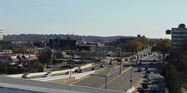
Looking south from the SW/SE Freeway:
Ramps to I-395 just north of I Street

http://www.jdland.com/dc/southcap.cfm

If it were to go under 1St Street SE, it would need to continue to the north of I Street SE through CSX owned railroad properties as essentially part of an all new underground interchange with a new underground SW/SE Freeway and the existing cut and cover I-395 Center Leg (3rd Street Tunnel. Connecting it to the existing ramps may be possible but would require additional temporary ramps: a less cost effective thing as about to be done at a cost of $47-118 million with the existing South Capitol Street viaduct.

Illustration: Jacqueline Dupree
Looking north to the SW/SE Freeway:
Ramps to I-395 just north of I Street

http://www.jdland.com/dc/southcap.cfm

Having it beneath South Capitol Street, or somewhat offset to the west would be easier to connect with the existing I-395 ramps just north of I Street as an interim fashion before a future project for an underground SW/SE Freeway and interchange, but as an interim project that would include portions of the tunnel retaining walls for the future transition, hence allowing the grade to be further excavated later at reduced cost.

Given the general rule of maintaining traffic during the construction period, space is required to construct one “strip” of the right of way” while another “strip” of right of way or adjacent land is used to route traffic. With the existing I-395 ramps to the east side of South Capitol Street, the tunnel route would have to swing to the immediate east for the connection, and surface at I Street, with an open depressed transition southward to K Street and a cut and cover transition southward to L Street or further.

Today there is primarily open space along the east side of South Capitol Street from I Street southwards to the north wall of St. Vincent de Paul Church which sits at the northeast corner of the intersection with M Street. At I Street sits an Exxon gasoline station. At K Street sits a plot – 1000 South Capitol Street -- that was purchased by the Lerner Group – which owns the Washington Nationals – which proposes a 325, 000 square foot office building . To the south of L Street sits 1100 South Capitol Street that was purchased by Lawrence Rubin Corporation in August 2004 for $4.8 million. Geometry requirements would mean that the southernmost of these properties required to “steer” a tunnel alignment beneath South Capitol Street from the east in order to avoid St. Vincent DePaul Church in its existing location, would be the Lerner group property.

What evidence is there of any right of way reservation from the Lerner Group property and the Exxon gasoline station -- properties 4 and 6 above -- respectively at 1000 and 950 South Capitol Street?

Illustration from South Capitol Street Waterfront Vision

Thursday, June 29, 2006

Or the Tunnel that at least becomes more expensive?

Officially it is still to be, but what about the details?

According to Kathleen Penney, from the Deputy Bridge Engineer for DDOT at the June 14, 2005 Public Scoping Meeting for the SCS EIS:

One of the things that we have talked about throughout the studies is the ability to build a tunnel to connect Interstate 295 and Interstate 395. That’s really a major part of the transportation component of the AWI. We are not showing it in any of our alternatives over hear because it’s really a common element that does not vary from alternative to alternative. So the tunnel along the South Capitol Street is still very much on the table. It’s very much in our analysis as we work through our traffic. But we expect as we go through this NEPA process that it will probably fall out on its own separate NEPA documentation process. And so we keep it on the table now. We analyze it and see how it affects all of the alternatives. But eventually, it will probably split off and take its own course.

This tunnel is absent in planning documents the 2003 NCPC SCS Urban Design Study and the DCOP SCS Gateway Improvement Study. Both of these included the tunnel as an integral component. But the November 2003 ULI SCS Advisory Services Panel Report, effectively omits it.

It does not come out and say that the tunnel should never be built. But it dismisses the need for any land portion for such a tunnel, without even mentioning it:

National studies show that where traffic is constrained, alternate routes are soon adopted by commuters. The proximity of the double-span 11th STreet Bridge further upriver makes this traffic approach feasible. It will make for a much more enhanced experience for pedestrians and commuters-- who will face a less trafficked, less congested South Capitol Street. The new corridor will be more desirable for residents, businesses and visitors. The panel suggests ways that additional lanes can be accommodated by eliminating or reducing a median, allowing the insertion of a center lane for left hand turning traffic. Even the option that incorporates a landscaped median suggests intermittent breaks, allowing a left hand turn lane proximate to each intersection.

Page 22

http://www.ncpc.gov/publications_press/s_cap/SCapitolStReport.pdf

It mention's the tunnel's under-river segment only once, in the very quote that I cited in my June 28, 2006 entry about the threatened demolition of the underpass at M Street:

First Priority Initiatives

In order to accelerate the neighborhood development process, the first project recommended for South Capitol Street is to:

Proceed immediately with the raising of South Capitol Street to an at grade street with a 130 foot right-of-way from the foot of the Frederick Douglass Bridge through to the I Street intersection in the north

Proceed immediately with removal of the grade separation at M Street and the 100 percent corner, and with establishing at-grade crossings at all of the intersections.

In order to preserve the traffic carrying capacity of the street, provide for left turn lanes, either continuously or intermittently.

These initiatives can proceed without waiting for resolution of the bridge alignment, for the studies to determine feasibility of the under-river tunnel…

Without even waiting for a study for the bridge and the tunnel, the Urban Land Institute Advisory Services Panel Report prescribes first eliminating the South Capitol Street- M Street underpass, hence increase the amount of traffic lights and the vehicular-pedestrian conflict- all for the sake of accelerating the real estate development.

Sure, if it is not worth mentioning such factors as soil conditions, and right of way issues, including those for the various transition areas to the surface. None of the studies ask if it can be bored (drilled) rather then cut and cover without requiring soil stabilization measures (in what is near the confluence of two rivers!) that would significantly increase the construction costs.

2004 DCDOT South Capitol Gateway Corridor and Anacostia Access Study

Parsons Brinkerhoff Quade & Douglas, Inc. Frank Lohsen McCrery, Architects Justice & Sustainability Associates, L.L.C. Joseph Passonneau & Partners

2005 NCPC South Capitol Street Grand Urban Boulevard and Waterfront Gateway
http://www.ncpc.gov/publications_press/s_cap/NCPC_SouthCapitolSt.pdf

2006 South Capitol Street Environmental Impact Statement
http://www.southcapitoleis.com/

None of these reports address the cost-constructability issues.

All though flirt with significant future cost increases, for the sake of making some real estate development occur 5-12 years sooner.

While none of these reports even address cost-constructability, and thereby neither tabulate the potential costs, they neither tabulate the benefits of speeding real estate development that would happen anyway.

Wednesday, June 28, 2006

The Tunnel That Was to be

District Office of Planning and U.S. National Capital Planning Commission


The idea of incorporating the excavation of the existing underpass within a 3 lane per direction cut and cover tunnel directly beneath the SCS row was included in planning in 2002-2003, along with the options of parallel alignments to the east, but not the west to minimize impacts on existing residential neighborhoods.


This tunnel was to extend initially north to I Street to meet the existing connections to the SW/SE/Center Leg Freeway, with design flexibility to for the latters’ underground replacement.


However, to its south, this tunnel would not have the option of surfacing onto the new bridge, but rather commit itself to the more ambitious and more expensive option of continuing it south beneath the Anacostia River to I-295 and the Suitland Parkway, with three lanes per direction.

In 2003, US NCPC and the DCDOP/DOT agreed that such a tunnel was vital for regional transportation and for a more pedestrian friendly South Capitol Street corridor. Their studies for the South Capitol Street corridor included this 6 lane cut and cover tunnel as a given with all three of the surface options then under formal consideration: namely, what was essentially the eastern half of the South Capitol Mall concept from Extending the Legacy, a 195 foot wide linear park; a narrower but symmetrical 100 foot median green way; and a third option to maintain the existing 130 foot right of way.

According to the January 2003 NCPC South Capitol Street Urban Design Study Chan Krieger & Associates Architecture & Urban Design, with Economic Research Associates (ERA) Economics Development

The best opportunity to redirect regional traffic lies with the long term redevelopment of the South Capitol Street corridor, which deserves to become a beautiful, ceremonial, vibrant, and mixed-use southern gateway to the Capitol. This transformation can be achieved only if much of the regional traffic that the corridor currently caries is redirected to a high-speed tunnel. Such a tunnel would more directly connect the Anacostia Freeway (I-295) and the Southwest Freeway (I-395). Regional traffic would travel from Anacostia Freeway under the River in the new tunnel, below South Capitol Street to I-395 at the Southwest Freeway. The Suitland Parkway approach to Washington would maintain its parkway quality, cross a new bridge at the Anacostia River and move along a more boulevard-like South Capitol Street, lined with a mix of office, retail, and residential uses.

A tunneled interstate connection along the South Capitol Street alignment will allow for traffic reduction at all river crossings and lead to lower vehicular speeds, wider sidewalks, added cycling lanes, and safer pedestrian crossings. Great boulevards such as Pennsylvania Avenue could thus be restored to provide retail shops and services for neighborhoods, and sites for new national monuments. (at page 41)


http://planning.dc.gov/planning/frames.asp?doc=/planning/LIB/planning/project/anacostia_waterfront/framework-pdf/6_Transportation.pdf&planningNav_GID=1708
According to the November 2003 District Office of Planning South Capitol Street Gateway and Improvement Study
A tunnel under the South Capitol Street corridor would provide a new link in the transportation network with many benefits. Much of the traffic now on South Capitol Street consists of trips through the corridor, not to it. A tunnel between I-295 east of the Anacostia River and the existing I-395 Third Street tunnel would carry trips bound for downtown Washington and beyond, removing the traffic from the surface streets. Constructing a tunnel to carry through traffic will alleviate congestion on South Capitol Street. This will be essential for South Capitol Street's transmogrification into the centerpiece of a pleasant and livable neighborhood. The tunnel would alleviate the burden of commuter traffic on the entire street network. Including a tunnel in the study area's improvements is the only scenario that permits the added benefit of removing the Southeast Freeway. The tunnel portals are a critical part of the study area's urban design considerations and can be configured in many different ways. East of the river, their design must respect the Popular Point parkland and Anacostia's historic neighborhoods. The north end of the tunnel, which connects to I-395 and the center leg tunnel, should be linked with the existing inter stare system without adversely impacting the area southwest of the U.S. Capitol grounds. (at page 74, section V Creating a Monumental Gateway-pdf)

Oddly, though this tunnel would connect two existing interstate highways, the cross section shown would be substandard to U.S. Interstate highway design by not indicating sufficent width for shoulders, even though there's sufficent space for such a cut and cover tunnel within the existing 130 foot right of way.

Recycling the existing underpass
within a longer cut and cover box tunnel

The existing underpass with it 2 lanes in each direction occupies less then half of the existing 130 foot lateral space between the buildings facing South Capitol Street, and is very little longer then that required to cross beneath M Street. This provides little space to widen the M Street overpass, e.g. it is unlike the open depressed northern Connecticut Avenue approach to DuPont Circle or portions of New York Avenue, hence this existing structure provides little opportunity to deck over the existing approaches that surface at N and O Street.

If the idea is to delete the open approaches for a more dignified setting for St. Vincents Church, and to confine construction to existing right of ways, deconstruct the transitions and incorporate the existing excavation into a larger cut and cover tunnel.

With outer and center tunnel walls each 4’ wide accommodating twin tunnel ways, the existing 130’ building line to building line right of way could provide 3 continuous lanes per direction flanked by 12’ and 10’ shoulders ( 4/12/36/10 /4/10/36/12/4= 128’)

To connect with an evolving road network, it would surface at its north at I Street to meet the existing connections to the SW/SW/Center Leg Freeway; and ultimately the latters’ underground replacement. To the south it would surface in the vicinity of Potomac Avenue, directing to the replacement South Capitol Street Frederick Douglass Bridge. This would include the concurrent or latter addition of a tunnel continuation southwards beneath the Anacostia River to connect with I-295 and the Suitland Parkway.

Why eliminate the underpass?

The two main reasons given in the various planning studies for eliminating the South Capitol Street Underpass at M Street are:

making the area more pedestrian friendly
providing a more dignified setting for St. Vincent De Paul Church

More pedestrian friendly?

Eliminating the underpass would increase vehicular-pedestrian conflict at M Street, as well as the streets to the south, where the median barrier would also be eliminated to allow pedestrians to cross at N Street.

South Capitol Street would become more pedestrian friendly insofar that pedestrians could cross at N Street (from existing residential neighborhoods to the stadium).

But since N Street is right between the South Capitol Street Underpass and the South Capitol Street Bridge, it’s a place where vehicular traffic is more likely to go faster, and hence undesirable for a pedestrian crossing. Indeed N Street is right where this viaduct – basically the land portion of the South Capitol Street Bridge that actually runs along the South Capitol axis touches down.

That is, until that segment of vehicular viaduct, is torn down, as was planned to happen in about 2014 after the replacement bridge was built alongside to the south. However, the supplemental $47-118 million interim plan would accelerate this viaduct segment’s demolition to 2006.

In light of their close proximity, one must run through the different possibilities for this underpass and this viaduct. Eliminating the viaduct first, or at least building a northbound ramp to 1st Street SE would better disperse traffic. Eliminating the underpass would serve as a bottleneck, and would be less needed to make the area to the south more pedestrian friendly by shortening the viaduct, which would allow an at grade intersection at O Street.

A more dignified setting for St. Vincent DePaul Church?

Eliminating the underpass eliminates the depressed approaches that representatives of St. Vincent DePaul Church from the Washington Archdiocese seem to find objectionable.

But eliminating the underpass is not required to address the underpass/viaduct proximity issues, nor is it required for eliminating the depressed approaches.

With officials stating their objectives as making South Capitol Street more pedestrian friendly, and with Catholic Church officials apparently objecting to the depressed approaches (at least the one to the north of M Street in front of the St. Vincent DePaul Church), a logical alternative would be to retain the underpass in a different form that eliminates the depressed approaches at and near St. Vincent DePaul Church via including its excavation as part of a longer cut and cover tunnel.

The threatened demolition of the South Capitol Street/M Street underpass

Imagine the government threatening to close and demolish the existing SCS underpass crossing beneath M Street., thereby placing all of that intersection’s traffic at an at grade traffic light intersection at M Street, while placing additional traffic lights along South Capitol Street at N and O Streets.

One will not have to image this to live it, if authorities go ahead with the recommendation of the 2003 Urban Land Institute “An Advisory Services Panel Report: South Capitol Street Corridor, Washington, D.C. Implementation Plan”

First Priority Initiatives

In order to accelerate the neighborhood development process, the first project recommended for South Capitol Street is to:

Proceed immediately with the raising of South Capitol Street to an at grade street with a 130 foot right-of-way from the foot of the Frederick Douglass Bridge through to the I Street intersection in the north

Proceed immediately with removal of the grade separation at M Street and the 100 percent corner, and with establishing at-grade crossings at all of the intersections.

In order to preserve the traffic carrying capacity of the street, provide for left turn lanes, either continuously or intermittently.

These initiatives can proceed without waiting for resolution of the bridge alignment, for the studies to determine feasibility of the under-river tunnel, or for the decision to eliminate any section of the Southwest/Southeast Freeway as an overhead facility and the restoration of Virginia Avenue. (at page 27-pdf) Any of these decisions can be made and the already completed section of South Capitol Street can be incorporated into the newer project. Meanwhile, the street can begin to function as a unifying center for the neighborhood, and can bring certainty to the landowners/developers on all the projects from Half Street SW to Half Street SE.

The schedule to close this underpass and to design its demolition may be as early as mid-summer 2006 – it is now June 28, 2006 – if included with the $47 to 118 million interim project to demolish the existing South Capitol Street Bridge land viaduct north of Potomac Avenue. The web site of the DC government offers no mention of the underpass demolition that I could find, while only mentioning the interim project to shorten the viaduct treated as a near footnote in D.C. Mayor Williams' announcement of the release of the bridge designs.

Second Priority Initiatives

The second set of initiatives which should be undertaken, while decisions are pending on projects with longer lead time, deal with reducing the length of the Frederick Douglass Memorial Bridge at the south end of South Capitol Street. Altering the viaducts to land at Potomac Avenue instead of almost at the intersection of N Street will:

Double the at-grade length of South Capitol Street, creating more available street frontage for ground level retail or commercial developement, while stitching the neighborhood togther into a cohesive whole; and

Initiate the process of street improvement potentally as much as 12 years before it otherwise could begin (i.e. before the new bridge is in place).

While we do know that the $47-118 million interim project starts sometime in 2006, it is the second of these two projects to occurr under the prescription of this November 2003 Urban Land Institute report, which prioritizes the underpass demolition first, and the viaduct project as second.

Meanwhile, this report lists the bridge project itself as a 3rd priority.

The South Capitol Street Bridge Project itself was scheduled to release its Draft Environmental Impact Statement in Summer/Fall 2006, and has not yet appeared.

Should not the EIS be finalized before any of this demolition or construction starts?
The South Capitol Street
Underpass at M Street


South Capitol Street Underpass at M Street

This underpass was planned in the 1950s, and completed by the early 1960s. It’s most similar structure in Washington D.C. is the North Capitol Street underpass beneath New York Avenue (below).

North Capitol Street Underpass at New York Avenue

It carries two lanes in each direction for South Capitol Street traffic, descending and ascending between N and L Streets, with a 3rd lane per direction proceeding through an at grade surface traffic light intersection with east-west surface M Street.

To its south, South Capitol Street has a median barrier to prevent all lateral access- both vehicular and pedestrian, with no traffic lights to the South Capitol Street Bridge. IOW no one may cross the street. But also, no one has to stop at a traffic light to get to the north of M Street, with right hand (but not left hand) turns allowed onto P, O and N Streets.

The two above illustrations are from the web site of the National Association to Restore Pride in the Nation's Capital:

http://www.narpac.org/REXLRPRO.HTM

Tuesday, June 27, 2006

Sparse newspaper coverage

June 26 DC Zoning Board hearing was well attended, with testimony continuing at least untill midnite, but sparsely reported.

From Jacqueline Dupree
The Stadium and the Zoning Commission
(6/26 9:06 PM) Starting a thread for whatever news comes out of tonight's Zoning Commission hearing on the baseball stadium (and the parking garages!)--Mayor Williams planned to testify, and here are his prepared remarks. UPDATE: The Washington Times says that the Zoning Commission was not anywhere close to impressed with the new garages plan ("Garages Proposal Roundly Criticized"). The short Post story ("Mayor Asks For Stadium Plan Approval") doesn't include any actual detail from the hearing.

http://www.jdland.com/dc/index.cfm

South Capitol Street/Frederick Douglass Bridge
Replacement


South Capitol Street EIS
Preliminary Build Alternatives 1,2,3


http://www.southcapitoleis.com/pdfs/SCS_EIS_Scoping_Mtg_Boards_for_Web4.pdf


Alternative 1


Existing M Street underpass

Traffic light intersections with Potomac Avenue
and Suitland Parkway, and with Sterling Avenue
Additional ramp to I-295


Alternative 2

Traffic light intersection with M Street
Traffic oval with Potomac Avenue
Traffic Circle with Suitland Parkway
Urban diamond grade separated interchange with I-295
Traffic light intersection of Suitland Parkway with Sterling Avenue
New center ramp ramps from Suitland Parkway to MLK Boulevard


Alternative 3

Traffic light intersection with M Street , Potomac Avenue and Suitland Parkway
New flyover interchange with I-295
Grade separated of Suitland Parkway crossing under Sterling Avenue

New center ramp ramps from Suitland Parkway to MLK Boulevard

South Capitol Street Bridge
Alignment Alternatives


From http://www.southcapitolstreetbridgestudy.com/
Two draft alternative bridge alignments have been developed. See alternative alignments here.

Compare these to the alignment shown in NCPC's 1997 "Extending the Legacy: Planning America's Capital for the 21st Century" (below).

South Capitol Street Bridge
Study Area


From http://www.southcapitolstreetbridgestudy.com/
The District Department of Transportation (d.) has commissioned a study for the replacement of the aging Frederick Douglass Memorial Bridge over the Anacostia River. The existing bridge, constructed in 1950, is structurally deficient, requiring a major rehabilitation effort. The new bridge will serve the community's need both aesthetically and functionally by providing transportation alternatives for vehicular, pedestrian, and bicycle traffic. The proposed bridge also is an essential element of the Anacostia Waterfront Initiative's vision of a grand gateway into the nation's capital across a world-class bridge that provides maximum value for all types of transportation users, while unifying and enriching the neighborhoods it connects.

The following will be completed as part of the study:
  • Identification, documentation and justification for protective buying as appropriate.
  • Study on river traffic, navigation, and bridge openings.
  • Contaminated soil and hazardous material site investigation.
  • Development of concept architectural, engineering, and alignment alternatives for four bridge types.

  • The South Capitol Street Bridge Study will run concurrently with the South Capitol Street Environmental Impact Statement (EIS) Project.


    http://www.southcapitoleis.com/

    Monday, June 26, 2006

    The South Capitol Street
    Bridge Project


    All of the 1997+ South Capitol Street related studies anticipate a replacement bridge project.

    http://www.southcapitolstreetbridgestudy.com/

    http://www.southcapitolstreetbridgestudy.com/documents/aerialBridge2.pdf


    South Capitol Street

    The Studies:

    The idea of reconstructing South Capitol Street into something at least prettier has been a planning thrust through numerous official studies.

    The studies:

    1997 Extending the Legacy: Planning America’s Capital for the 21st Century

    http://www.ncpc.gov/publications_press/legacycontents.html

    2003 Anacostia Waterfront Initiative

    http://www.planning.dc.gov/planning/cwp/view,a,1285,q,571105,planningNav_GID,1708,.asp

    2003 NCPC South Capitol Street Urban Design Study

    http://www.ncpc.gov/publications_press/Press_Releases/2003/pr060503_2.html

    http://www.ncpc.gov/publications_press/s_cap/part_1.pdf
    http://www.ncpc.gov/publications_press/s_cap/part_2.pdf
    http://www.ncpc.gov/publications_press/s_cap/part_3.pdf

    2003 DCDOP South Capitol Street Gateway Study

    http://ddot.dc.gov/ddot/cwp/view,a,1247,q,560731.asp
    http://ddot.dc.gov/ddot/frames.asp?doc=/ddot/lib/ddot/information/documents/frames/south_capitol/pdf/sc_cover.pdf

    2003 Urban Land Institute “An Advisory Services Panel Report: South Capitol Street Corridor, Washington, D.C. Implementation Plan”

    http://www.ncpc.gov/publications_press/s_cap/SCapitolStReport.pdf

    2004 DCDOT South Capitol Gateway Corridor and Anacostia Access Study

    Parsons Brinkerhoff Quade & Douglas, Inc. Frank Lohsen McCrery, Architects Justice & Sustainability Associates, L.L.C. Joseph Passonneau & Partners

    Note: this is the same Joseph Passonneau and Passonneau & Partners that produced/showed the “South Capitol Avenue” (my name, not theirs AFAIK) in the August 2000 presentation at the National Building Museum.

    2005 NCPC South Capitol Street Grand Urban Boulevard and Waterfront Gateway

    http://www.ncpc.gov/publications_press/s_cap/NCPC_SouthCapitolSt.pdf

    South Capitol Street Environmental Impact Statement

    http://www.southcapitoleis.com/

    Traffic issues

    Adding 41,000 seat baseball stadium next to an 6 lane bridge and surface arterial with a 4 lane underpass to cross beneath M Street, that compose a corridor that is anticipated to be entirely rebuilt shortly afterwards.

    What shall be the long term effects upon traffic? (including evacuations)

    Sunday, June 25, 2006

    The South Capitol Stadium:
    the least favored site,
    according to a 2003 Washington Post poll

    In 2003, The Washington Post conducted a survey on the three following choices:

    From: http://www.washingtonpost.com/wp-srv/polls/sports/dcbase_0226.htm
    ---

    The Possible Sites

    RFK Stadium
    At a cost of $342 million, and built on land already controlled by the city, the RFK Stadium site would be the most inexpensive of the five options. However, the surrounding area would lack the amenities expected at other sites, such as restaurants and shops.

    RFK Stadium


    New York Avenue
    New York Avenue
    The New York Avenue site would be built near a new Metro stop currently under construction at a cost of between $411 million and $436 million.


    M Street SE/ Anacostia Waterfront
    Located adjacent to South Capitol Street, the Anacostia waterfront location has a projected price tag of between $411 million and $436 million.

    Anacostia

    Note: All facilities would need easy access to Metro and regional highways, ideally have views of the U.S. Capitol or Washington Monument, and seat about 41,000 people.

    Note: This is an unscientific survey of washingtonpost.com readers.

    SOURCE: Brailsford & Dunlavey; Ehrenkrantz Eckstut & Kuhn Architects
    Graphics by BILL WEBSTER, DICK FURNO AND CHRIS KIRKMAN -- THE WASHINGTON POST


    © Copyright 2003 washingtonpost.com
    ---


    Where should the District locate a new baseball stadium?
    13855 responses so far:
    RFK Stadium Bar chart
    (33.8%), 4677 votes
    New York Avenue Bar chart
    (41.6%), 5760 votes
    M Street SE Bar chart
    (24.7%), 3418 votes

    Note: This is an unscientific survey of washingtonpost.com readers.