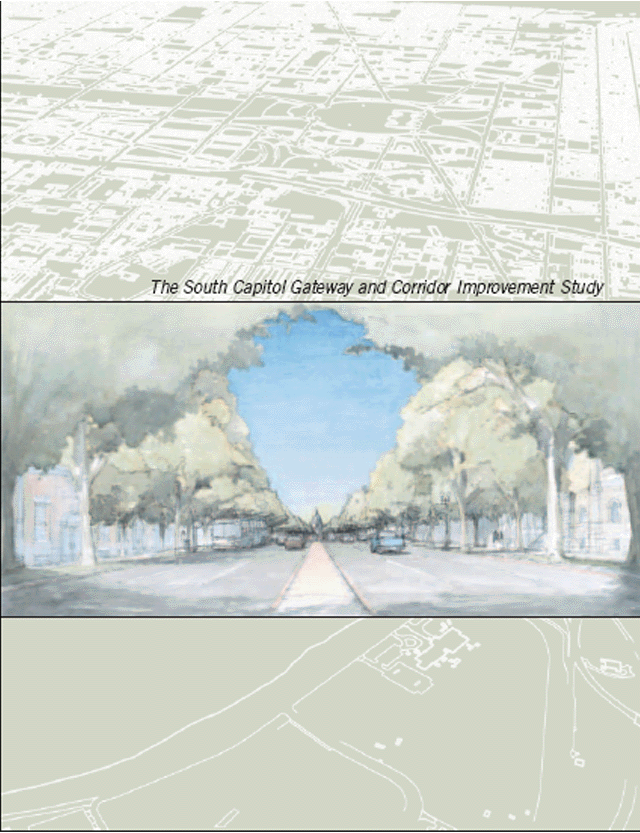
 What the 2003 South Capitol
 Urban Design and Gateway
studies would have done:
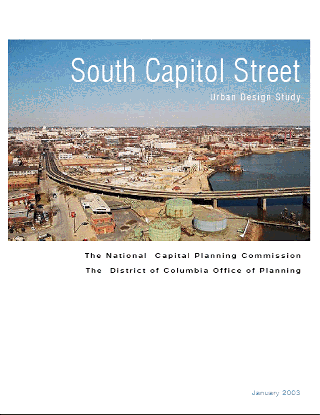
2003 NCPC
http://www.ncpc.gov/publications_press/s_cap/part_1.pdf
http://www.ncpc.gov/publications_press/s_cap/part_2.pdf
http://www.ncpc.gov/publications_press/s_cap/part_3.pdf
Published February 2003. NCPC press release July 2003. Presents 3 options:
"C" 325' total right of way with 195' linear park offset east
"B" 220' total right of way with 100' median park
"A" 130' total right of way with wider sidewalks created by eliminating one lane per direction.
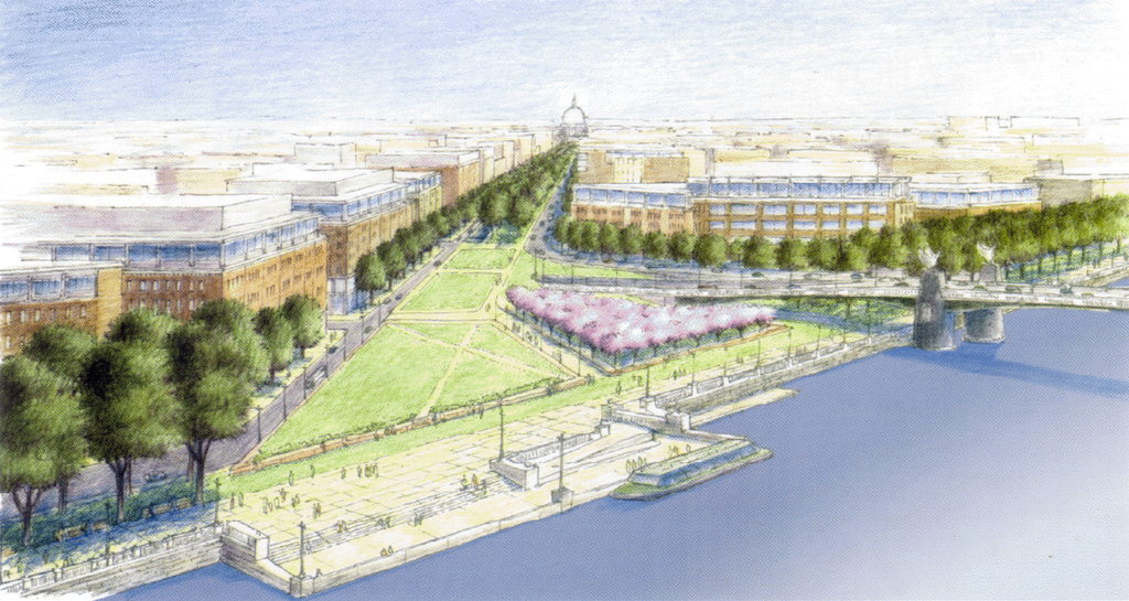
Option "C" roughly represents the eastern half of what appears in 1997 and 2001. Obstensibly this was done to avoid property displacement to the west, such as the neighborhoods along Half Street and Carrollsburg Place SW.
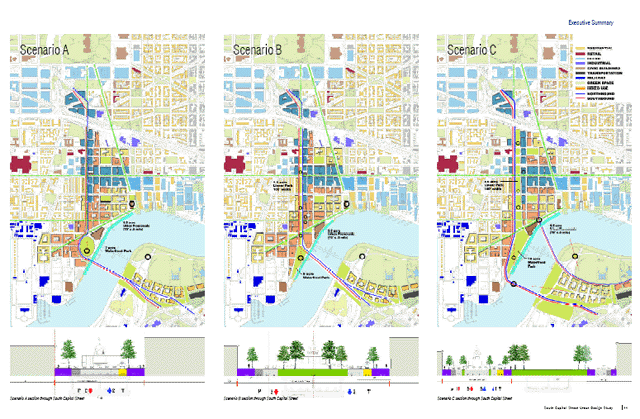
All include a 6 lane vehicular tunnel, with "B" and "A" placing it directly under South Capitol Street, and "C" placing it to the east beneath the 195' wide linear park.
Of the options themselves:
Options "C" and "B" displace St. Vincent de Paul Church from its existing location
Option "A" does not.
Option "C" displaces only 4 residences (since demolished for the stadium)
Option "B" displaces 34 residences along west side of South Capitol Street between O and P Streets
Option "A" displaces no residences, and has the stated advantage of not requiring property acquisitons.
According to a June 5, 2003 NCPC press release:
The key urban design principles outlined in NCPC’s study include:
-
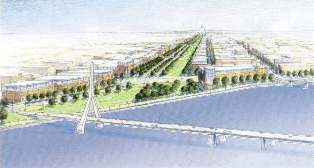
Create a great urban boulevard that serves local neighborhoods as well as regional and national visitors.
-
Establish a linear park along the length of a new South Capitol Street that will connect the Mall and Capitol Hill with the Anacostia River.
-
Create a great civic space on both sides of the river where South Capitol Street meets the Anacostia River.
-
Improve local and commuter traffic flow and create a ceremonial approach to the Capitol Building from the Suitland Parkway.
-
Replace the existing Frederick Douglass Bridge with a more beautiful and memorable gateway to Washington’s Monumental Core.
-
Align the new river crossing to minimize highway ramp infrastructure and provide greater flexibility for future development on Poplar Point.
-
Strengthen existing neighborhoods within the corridor, along New Jersey Avenue, and on Buzzard and Poplar Points.
-
Create a surface roadway that retains the street’s current 130-foot width and provides additional space for parks, memorials, and pedestrian amenities along its length;
The additional space would be provided by eliminating one vehicular traffic lane per direction to allow widening the sidewalks. Eliminating these traffic lanes was said to be be allowable by the includion of the 6 lane tunnel beneath or alongside South Capitol Street to connect I-295 with I-395 that appears in all 3 options.
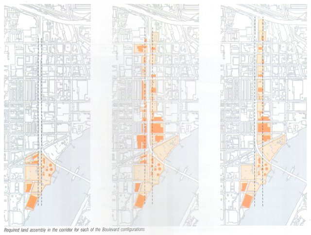
This does not neccessarily guarante against such displacement from adjoining development. The isometric renderings below show ALL of these options, including "A", accompanied by new adjoining development that displaces the residences on the west side of South Capitol Street, plus an unclear amount further west.

2003 DCDOP
http://ddot.dc.gov/ddot/cwp/view,a,1247,q,560731.asp
http://ddot.dc.gov/ddot/frames.asp?doc=/ddot/lib/ddot/information/documents/frames/south_capitol/pdf/sc_cover.pd
Only the above option "A" appears.
 Shows St. Vincent de Paul Church in its existing location.


1 comment:
Douglas,
I am a commercial real estate appraiser with Cushman and Wakefield in Washington, DC and have seen your name pop up in/on numerous articles/message boards as the guru on Highway design. I actually do a lot of work in the Southeast/Southwest DC area and was interested in speaking with you to get your thoughts on the SE/SW freeway (history, affect on surrounding neighborhoods, future developments, etc.). I was also interested in finding out how to gain access to your Takoma Park Highway Design Studio website - www.highwaysandcommunities.com (I tried visiting, but was prompted for a password). Thanks, and I look forward to speaking with you.
Fred Irby, IV
Appraiser
Cushman & Wakefield of Washington, D.C., Inc.
1801 K St., NW Suite 1100-L
Washington, D.C. 20006
202-739-0378 (direct)
202-223-8963 (fax)
fred.irby@cushwake.com
Post a Comment